Geofencing is a location-based technology that creates a virtual boundary around a physical area and triggers automated actions when workers or tagged assets cross the boundary.
In the era of Real-Time Location Systems (RTLS) and connected worker solutions, geofencing has evolved from a marketing tool into a mission-critical capability for safety, Regulatory compliance, and asset Management—especially in high-risk sectors such as oil & gas.
What is Geofencing?
At its core, geofencing defines a Virtual geographical-boundary—such as a circle, polygon, or beacon zone—around a specific site, zone or asset. When a device (mobile phone, wearable tag, vehicle tracker) crosses this boundary, the system triggers predefined rules: send an alert, lock/unlock equipment, record an entry, initiate a mustering rollcall, or launch automated workflows.
Because geofencing tie’s location to action, it’s widely used for:
- Safety: (restricting entry to hazardous zones),
- Security: (alerting on unauthorized access), and
- Operational automation (kickoff inspections, updating shift statuses automatically).
Types of Geofencing
Geofencing technologies are typically categorized based on how the virtual boundaries are defined and enforced:
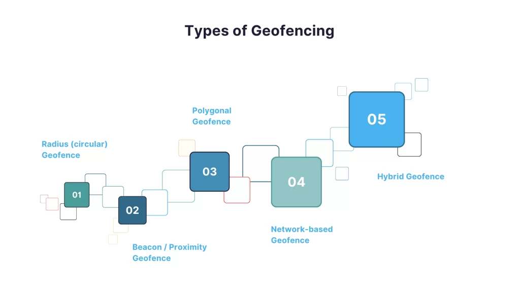
- Radius (circular) Geofence – Defined by a central point and radius (e.g., a100 meter zone around a wellhead). Easy to set up and configure and well-suited for outdoor areas.
- Polygonal Geofence – Irregular shapes that match real-world site Layouts (e.g., specific pads on a rig or a plant perimeters). Offers greater precision for complex sites
- Beacon / Proximity Geofence – Uses Bluetooth Low Energy (BLE) or RFID beacons to create very short-range zones such as rooms, cages, or equipment cabinets. Ideal for indoors where GPS signals are weak or unavailable.
- Network-based Geofence – Uses Wi-Fi or cellular cell IDs to infer presence in areas with poor satellite coverage.
- Hybrid Geofence – Combines GPS technology for outdoors and BLE/RFID indoors providing seamless location tracking and rule enforcement as users move between environments—a common approach in RTLS deployments.
Geofencing Technologies — How They Work
Geofencing relies on one or more positioning technologies to define and monitor virtual boundaries:
- GPS / GNSS — accurate outdoor positioning; typical for vehicles, field crews and offshore platforms (when connected).
- RTLS platforms — often fuse multiple inputs (sensor fusion) and apply techniques like smoothing, dead-reckoning and logic to keep geofence events reliable across environments
- BLE (Bluetooth Low Energy) — A short-range, low power technology; perfect for indoor room-level detection using beacons or wearable tags.
- RFID — passive or active tags read by fixed readers; excellent for gate control, tool crib access, and inventory management zones.
- UWB (Ultra-Wideband) — high-precision indoor positioning (sub-meter accuracy); used where pinpoint accuracy is essential.
- Wi-Fi & Cellular — coarse location estimates are useful where other signals may be weak or unavailable.
Industry Use Cases (Real-World Applications)
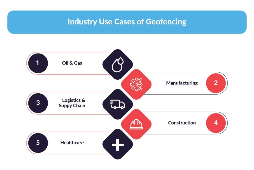
1. Oil & Gas
- Restricted zone enforcement: Prevent non-authorized personnel from entering high-risk areas (e.g., hot work sites, flare stacks).
- Automated mustering: In emergency situations, geofencing helps accounting for personnel within designated safe zones and facilitating faster evacuations.
- Pipeline access control: Alert when service vehicles approach sensitive pipeline sections.
Why it matters: In remote oil & gas operations timely situational awareness can save lives saved and minimize environmental risks.(RTLS + geofence = mustering + fall-detection workflows.)
2. Manufacturing
- Zone-Based Safety Rules: Automatically Shut down machinery if a person enters a hazardous cell.
- Workflow automation: Start/stop processes as materials move into designated production zones.
3. Logistics & Supply Chain
- Dock and Yard Management: Automatic check-in/ check-out of trailers and containers to accelerate turnaround times.
- Cold-Chain Alerts: Trigger monitoring whenever a pallet leaves a temperature-controlled environment.
4. Construction
- Access Control & Compliance: Ensure only trained workers enter high-risk lifts or confined spaces.
- Equipment protection: Alert if high-value equipment moves offsite without authorization.
5. Healthcare
- Patient and Asset Safety: Prevent unauthorized movement of medical equipment and continuously monitor vulnerable patients in wards.
Turning Location Data into Life-Saving Decisions
Geofencing is a fundamental capability in modern safety and operational systems. When combined with RTLS and robust communication networks, geofencing technology turns location data into actionable responses—such as automated mustering, restricted-zone enforcement, and process automation that significantly improve safety and productivity.
For industries operating in harsh or remote locations—particularly oil & gas—geofencing delivers the situational awareness required to protect people, assets, and the environment.